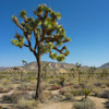
Ryan Mountain, Joshua Tree CA
• 4-star hike
• 3 mile out-and-back
• Moderate | Gain 1,070ft
• Twentynine Palms, CA | Joshua Tree
.

Heading back down, with popular climbing spot Hall of Horrors below.
Carved out of the side of one of the most prominent mountains in the Joshua Tree National Park, the Ryan Mountain trail snakes up the Western flank at a consistent angle of ascent.
The efforts of the climb are quickly rewarded as you are afforded increasingly dramatic views to the North West, including Intersection rock and Keys Desert. About half the way around the mountain you’ll happen upon a saddle, and you’ll now have an entirely new set of expansive and spectacular views to the East. Continue at an even pace to reach the mostly flat-topped summit and enjoy the views all around you.
| ⬤
4★ Ryan Mountain Trail
AllTrails · GPX File · Directions GPX? |
Conditions along this trail are mainly rocky with some short sandy stretches. We’ll admit to being disappointed with the over-use of stone steps for the trail’s construction. Sure, popular trails need good erosion control, but many of the steps seemed to be unnecessary and punishing - particularly on the way down. This fact alone almost made us reduce the trail to three stars, but maybe we just have old knees.
The trailhead is immediately accessible from Park Boulevard and is on the larger side. Still, during peak times this is likely to be full to bursting. Remember to check out the nearby adobe ruins of Ryan Ranch - relics of an estate built by the operator of nearby Lost Horse Mine in the late 1800s.

Photo opportunity by the trailhead. | The rounded Ryan Mountain summit.

Ryan Mountain brings fresh, elevated perspectives to Joshua Tree.
⚠ Heat Safety Tips: Shade is extremely limited on this trail. Please stay safe in hot weather by knowing the forecast and planning to avoid the hottest parts of the day. Recognize danger signs and turn back when necessary. Wear lightweight non-cotton clothing and head coverings. Use sunblock and UV chapstick. Bring more water than you think you need, coupled with salt & electrolite tablets.
Tangents:
• Official: Joshua Tree National Park
• AllTrails Public: Official, Ryan Mt Tr
• Facebook Group: Comment, Follow Us

Joshua Tree's Best Trails
The hikes around Joshua Tree National Park reviewed and categorized.
The hikes around Joshua Tree National Park reviewed and categorized.

Trailspotting the Southwest
See our growing collection of hikes from the Southwestern US states.
See our growing collection of hikes from the Southwestern US states.

Best Trails of California
See our favorite hiking trails for each region of California.
See our favorite hiking trails for each region of California.


