Perimeter Loop, Angel Island CA
• 4-star hike
• 5 mile loop
• Moderate | Gain 580 feet
• Angel Island, CA | San Francisco Region
.

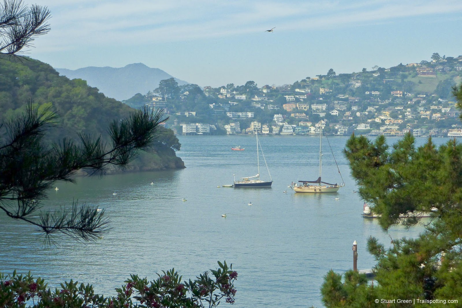
Ayala Cove towards Tiburon, with a distant Mount Tamalpais.
Whether you're in search of tranquility, great views, or a little history lesson, Angel Island is the perfect choice. Situated in the middle of the San Francisco Bay and surrounded by water on all sides, the short ferry journey to the island transports you away from the hustle of the city and into a different world.
Separated from the mainland since the last ice age 10,000 years ago, the island was used almost exclusively for grazing livestock until the military established a base here during the American Civil War in 1863. Virtually every part of the island has been shaped by military presence in some way.
Upon arriving by ferry at Ayala Cove, you'll find restrooms, a café, and bicycle rentals close to the ferry dock. Be mindful that even the busiest ferry route to Angel Island is limited, so be sure to know the time of the last boat off the island.
| ⬤ 4★ Perimeter Loop
GPX File · AllTrails · Directions GPX? |
| $ State Park fee (inc in ferry ticket price) |
We recommend a five-mile walking tour around the island's circumference to take in the major sights and curiosities, including military batteries and barracks, the immigration station known as the "Ellis Island of the West," and picture-perfect views all around the bay.
Angel Island welcomed nearly a million immigrants between 1910 and 1940. While most were processed within three days, 175,000 Chinese immigrants faced months of confinement due to exclusion laws. In 1940, operations ceased after the administration building burned. The large barracks and a portal recreation remain. Now a National Historical Landmark, the site retells immigrant stories through memorials and guided tours of the barracks museum. Visitors can explore the grounds freely, though museum tour fees apply.

Abandoned buildings and equipment are all around
On the west side of the island, we've marked an additional mile-long side trip on a single-track trail to Point Stuart, which winds through a wooded area and across a short ridgeline. Point Stuart was the site of a gun battery, and although there's no remaining evidence of this now, from here there are plenty of calm, quiet views of the San Francisco Bay toward both Tiburon and Alcatraz Island.
The island is accessible from Pier 39/41 at the heart of Fisherman's Wharf or from a separate ferry service operating from Tiburon. Be sure to plan ahead as services to the island are limited, and you'll want to make sure you'll have enough time to experience the best of the island before jumping on the last ferry home.

Awesome views from every part of Angel Island.

Quarry Beach only gets morning sun, but great day-long city views.
Tangents:
• Ferry Directions: San Francisco, Tiburon
• Official: CA State Parks
• AllTrails Public: Perimeter Loop
• Facebook Group: Comment, Follow Us


San Francisco Bay's Best Trails
For great hiking trails throughout the Bay Area check these out.
For great hiking trails throughout the Bay Area check these out.

Best Trails of California
See our favorite hiking trails for each region of California.
See our favorite hiking trails for each region of California.


