Mount Tallac, Lake Tahoe CA
• 5-star hike
• 9 mile out-and-back
• Hard | Gain 3,260 ft | Peak 9,735 ft
• Meyers, CA | Lake Tahoe
.

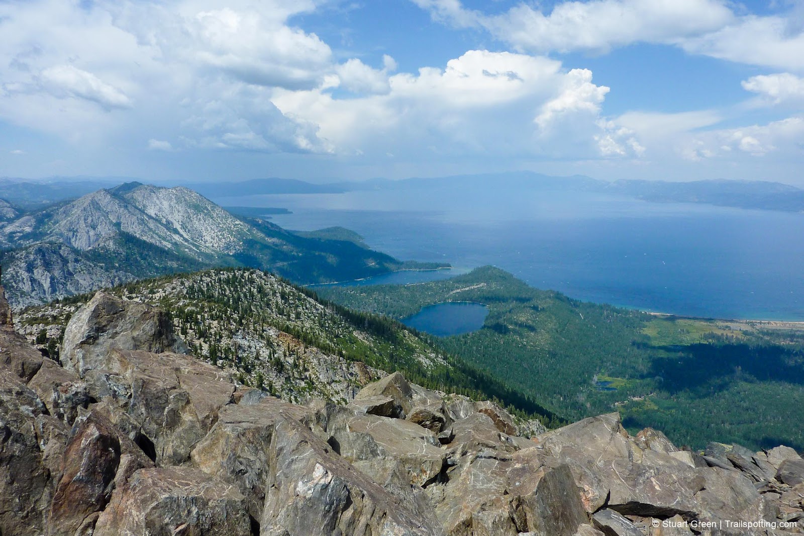
Views across Lake Tahoe from Mount Tallac's summit.
The jewel in the crown of mountains which ring Lake Tahoe, Mt. Tallac promises unparalleled views from its summit 9,735ft above sea level. This prominent peak stands as one of the most rewarding day hikes in the Tahoe Basin, offering exceptional views of Lake Tahoe, Fallen Leaf Lake, and the surrounding Sierra Nevada range.
Our trail map takes you to the top via the most direct summer route; through lush forest, along scenic ridgelines, past small alpine lakes and across colorful wildflower-strewn high-altitude meadows. Sure the 3,260 feet of elevation gain is greater than you might experience on many day hikes, but both the journey and the destination are worth every single thigh-burning step.
Starting at the well-marked trailhead off Highway 89 (approximately 3.5 miles north of Camp Richardson), the path begins at 6,240 feet and progresses through several distinct zones. The initial miles pass through mixed conifer forest before reaching Floating Island Lake at the 1.6-mile mark. After another 0.8 miles, hikers reach Cathedral Lake, which offers a good resting point before the more demanding sections ahead.
| ⬤ 5★ Mt Tallac Trail
GPX File · AllTrails · Directions GPX? |
| P Free parking |
Beyond Cathedral Lake, the trail emerges from the forest and begins climbing more steeply along a ridge. This open terrain provides increasingly expansive views of the Tahoe Basin. The final mile presents the steepest section, climbing through a series of switchbacks over loose rocky terrain to the broad, flat summit area.
June to October is the best time to hike Tallac and although some snow may prevail at higher elevations until late July, it's unlikely to cause problems for hikers. Summer thunderstorms are common from mid-afternoon, so we recommend an early start to avoid being exposed at high elevations at these times.
Remember to register for your Desolation Wilderness permit at the Mount Tallac trailhead, which is thankfully free to day hikers. Overnight backpackers are required to arrange their paid permit in advance through recreation.gov.

Desolation Wilderness mountain range to the southwest.

More views from the summit.
Tangents:
• Official: Forest Service
• AllTrails Public: Mount Tallac Trail
• Facebook Group: Comment, Follow Us

Trailspotting Nearby
4★ Echo Lake (3-9 mi) ·
3★ Ralston Peak (7 mi) ·
5★ Round Top (5-10 mi) ·
Show Map

Lake Tahoe's Best Trails
All-year-round fun at this Northern California landmark. Trailspotting has Lake Tahoe hikes for everyone.
All-year-round fun at this Northern California landmark. Trailspotting has Lake Tahoe hikes for everyone.

California Summits
Explore mountain-top hikes around California with Trailspotting.
Explore mountain-top hikes around California with Trailspotting.


