Best of Lassen Region, CA
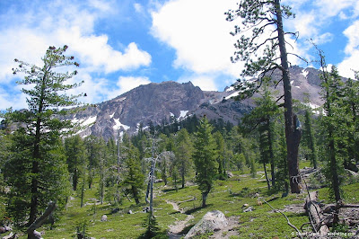
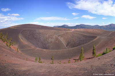
 Lassen Volcanic National Park is a jewel in Northern California’s crown yet for many it lays undiscovered. Situated on the southern tip of the Cascade mountain range the park is teeming with signs of present and historical volcanic activity, playing host to all five different types of volcano and other geological oddities. While Lassen Peak is the obvious poster child, there are many places to explore.
The park is worthy of a multi-day visit, which easily justifies the three-and-a-half hours journey from San Francisco. Compared with an equally distant Lake Tahoe, you’d find Lassen Volcanic National Park a remarkably quiet landscape.
During summer months visitors can freely pass through the park from North to South. The road however is impassible usually between November and May, depending on conditions, so we've broken our hiking recommendations into South and North sections for those who have the option to visit only one side of the park.
Lassen South
.
Regional Map
Regional Map
Regional Categories
| • Rating | |
| • Difficulty | |
| • Mileage | |
| • 4+ Star Hikes |
Tangents:
• Official: Lassen Volcanic NP
• Facebook Group: Comment, Follow Us

Best Trails of California
See our favorite hiking trails for each region of California.
See our favorite hiking trails for each region of California.

Lake Tahoe's Best Trails
All-year-round fun at this Northern California landmark. Trailspotting has Lake Tahoe hikes for everyone.
All-year-round fun at this Northern California landmark. Trailspotting has Lake Tahoe hikes for everyone.
Yosemite's Best Trails
Epic scenery and adventures await. Summit hikes, waterfalls and more to choose from.
Epic scenery and adventures await. Summit hikes, waterfalls and more to choose from.


