
Camelback Mountain, Phoenix AZ
• 5-star hike
• 2 to 3 mile options
• Moderate | Gain 1,150 to 1,380 feet
• Phoenix, AZ | Southwest US
.
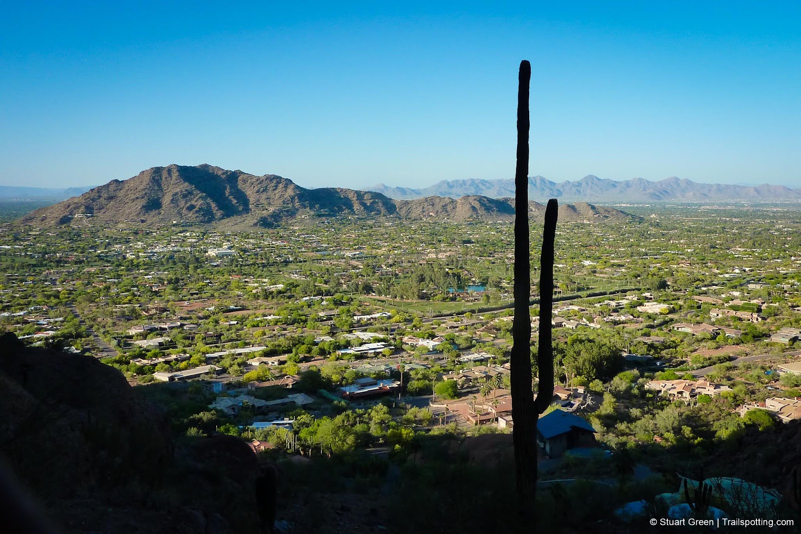
Camelback Mountain offers a variety of challenges.
Distinctive and dominant on the Phoenix landscape, Camelback Mountain is just begging to be conquered. The two different routes to the 2,680ft summit offer different challenges, and both are featured in this guide. No matter which way you summit the mountain, now from wherever you are in Phoenix you can look at the most dominant feature on the landscape and think "I climbed that".
The Echo Canyon Trail is by far the more popular route up Camelback Mountain, and for good reason. Not only is it more accessible for the Phoenix metropolis but it also offers a memorable and varied hiking experience.
| ⬤ 5★ Echo Canyon Trail
GPX File · AllTrails · Directions GPX? |
| ⬤ 5★ Cholla Trail
GPX File · AllTrails · Directions |
Sandstone rock on the Echo Canyon trail can be slippery at times, so despite a number of handrail opportunities a good pair of shoes would be advantageous. Also note that trailhead parking is often brutally limited and restrictions are enthusiastically enforced.
Alternatively, the Cholla Trail is a less well known route that sees less traffic. The trail heads up a well maintained trail on Camelback's east flank, but becomes a challenging and technical ascent upon reaching the ridgeline. This fun 1.3 mile route becomes increasingly rocky and precipitous, and though the conditions here are not extreme, we'd certainly urge caution and wouldn't recommend this route for young children or folk with a strong aversion to heights.
There is no parking at the trailhead, and parking at East Cholla Lane is off-limits. Closest parking available is around 0.3 miles away on Invergordon Rd just south of the intersection with Cholla. Invergordon Rd parking operates limited hours, so be careful to read posted signs. Some neighboring streets to the east have no parking restrictions and just make for a slightly longer hike.
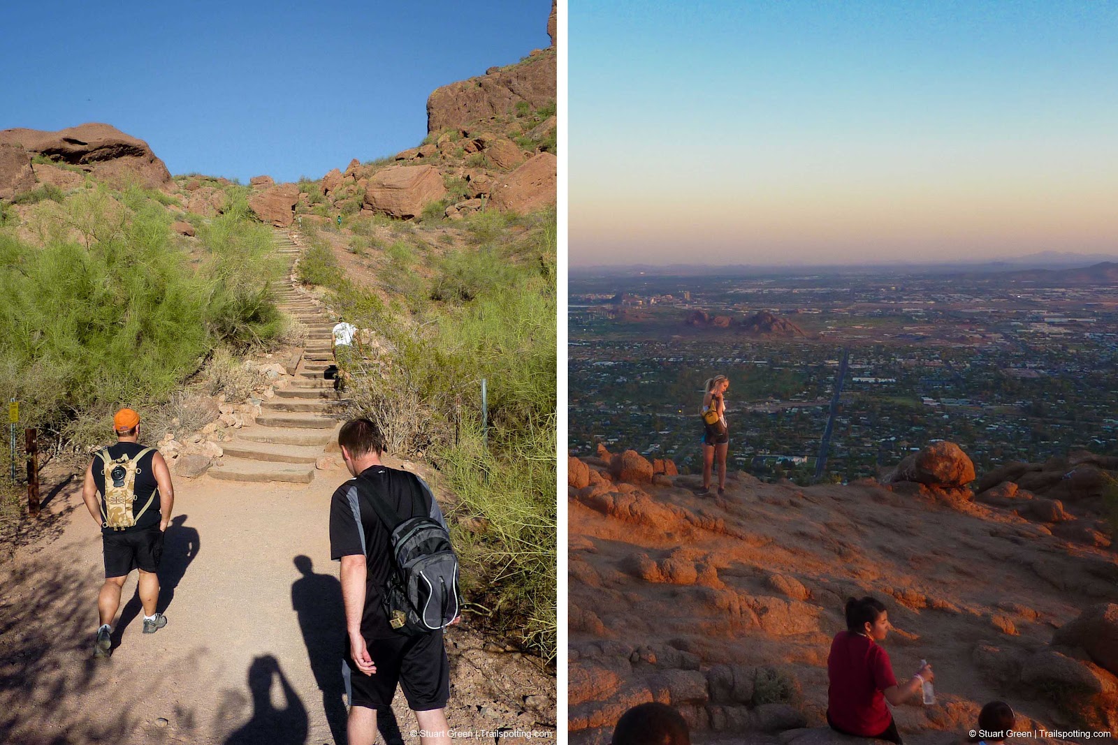
Echo Canyon Hike | Summit Views.
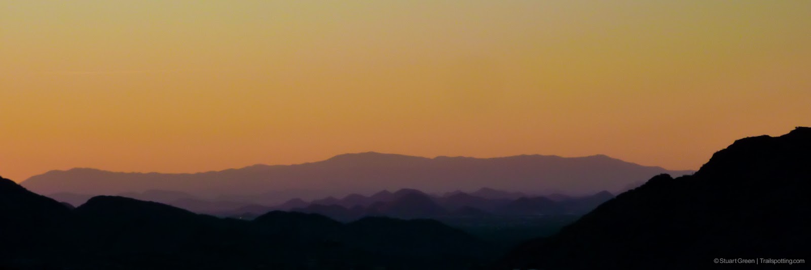
Sunset views on an evening Camelback hike.

A dusk hike up the steeper Cholla Trail.
⚠ Heat Safety Tips: Shade is extremely limited on this trail. Please stay safe in hot weather by knowing the forecast and planning to avoid the hottest parts of the day. Recognize danger signs and turn back when necessary. Wear lightweight non-cotton clothing and head coverings. Use sunblock and UV chapstick. Bring more water than you think you need, coupled with salt & electrolite tablets.
Tangents:
• Official: Phoenix P&R
• AllTrails Public: Camelback Mt
• Facebook Group: Comment, Follow Us

Trailspotting the Southwest
See our growing collection of hikes from the Southwestern US states.
See our growing collection of hikes from the Southwestern US states.

Best Trails of California
See our favorite hiking trails for each region of California.
See our favorite hiking trails for each region of California.


