
Mt Barnabe, Samuel P Taylor State Park CA
• 4-star hike
• 5 mile loop
• Moderate | Gain 1,300 feet
• San Geronimo, CA | San Francisco Region
.
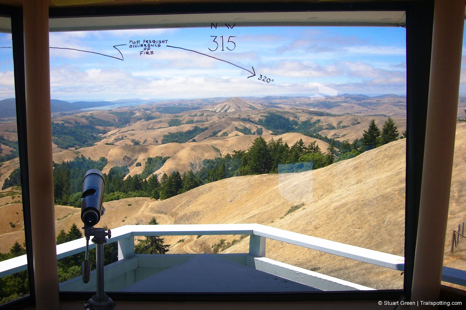
Southerly views from inside the active fire tower atop Mount Barnabe.
The Marin headlands across the Golden Gate Bridge from San Francisco offer tons of sightseeing potential, but doesn't everyone know it. Areas like Muir Woods and Stinson Beach are choked with traffic every fair weather weekend. Choose to drive an extra few miles, leaving the melee behind you and you'll be rewarded with empty roads and quiet trails.
We recommend the Mount Barnabe hike, which rewards with views of Tomales Bay, Mount Tamalpais and the surrounding headlands. To reach the trailhead, exit the 101 and drive 15 miles North along Sir Francis Drake Boulevard to a parking area located on the left, just past Samuel P Taylor State Park.
| ⬤
4★ Mt Barnabe Loop
GPX File · AllTrails · Directions GPX? |
| $ CA State Park fee |
Once you've kitted up, cross the road and enter the trail marked 'Devils Gulch Horse Camp'. Veer to the right and follow the stream to a bridge, walk across the bridge and then head left into dense forest. The first three miles of this five mile route will take you on a gradual rise up the mountain and through the forest, suddenly breaking out into sunlight, surrounded by grassland and turkey vultures.
When you head up to the summit of the mountain be sure to check out the fire tower. Manned during fire season, the fire-watchers sometimes welcome visitors into the tower which affords some even greater views, and some local insights. The return trip is a relatively fast one, directly down the fire road and back to the trailhead.
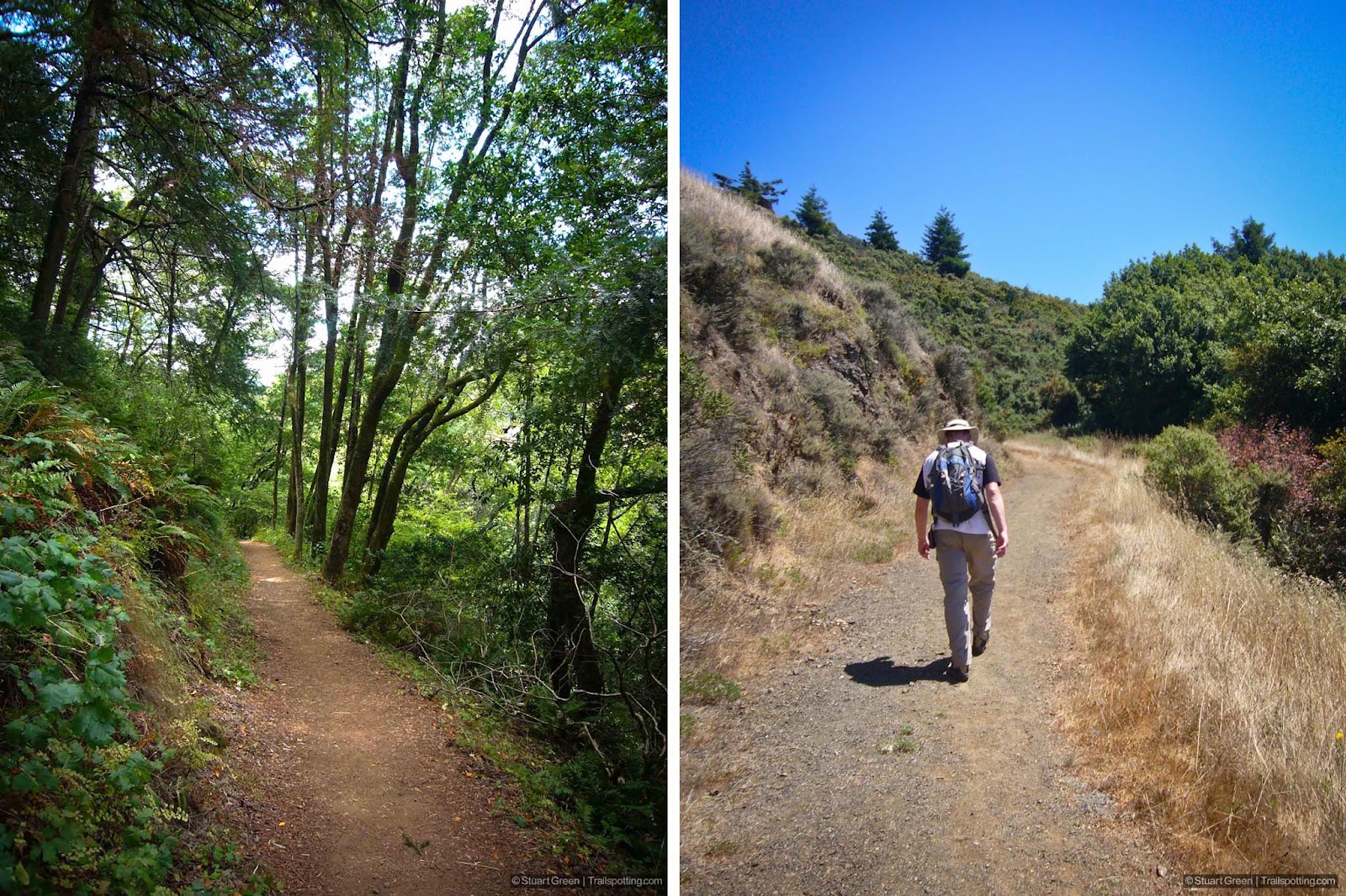
Shaded trails from the trailhead, leading to exposed grassland above.
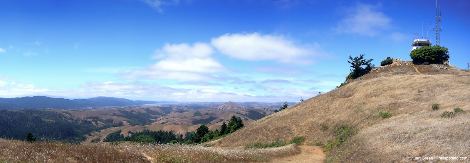
Mount Barnabe's summit and fire tower. Tomales Bay in the distance.
Tangents:
• Official: CA State Parks
• AllTrails Public: Mt Barnabe
• Facebook Group: Comment, Follow Us

San Francisco Bay's Best Trails
For great hiking trails throughout the Bay Area check these out.
For great hiking trails throughout the Bay Area check these out.

California Summits
Explore mountain-top hikes around California with Trailspotting.
Explore mountain-top hikes around California with Trailspotting.

Best Trails of California
See our favorite hiking trails for each region of California.
See our favorite hiking trails for each region of California.


