
Sonora Peak CA
• 4-star hike
• 4 mile out-and-back
• Moderate | Gain 1,980 ft | Peak 11,431 ft
• Sonora Pass, CA
.

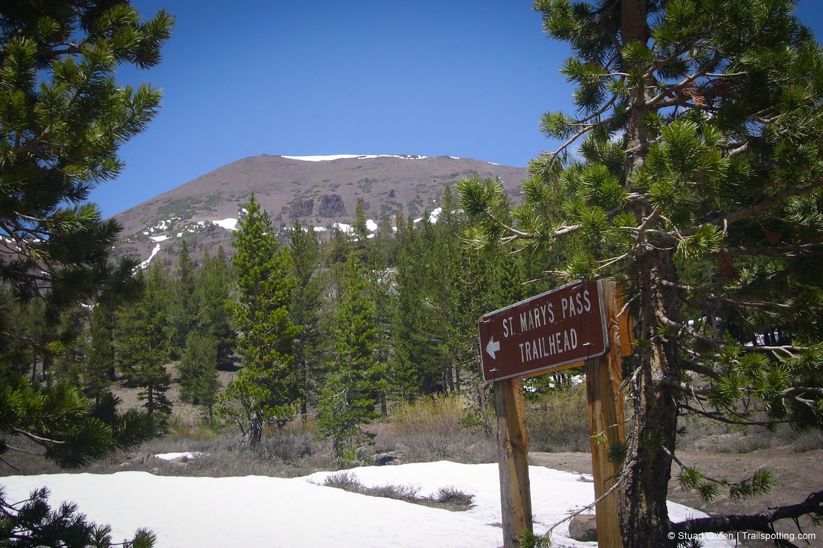
In stark contrast to the bustling crowds of Yosemite, the Stanislaus National Forest offers adventurous hikers open roads, dramatic scenery, and a refreshing absence of tour buses. Nestled at the highest point of CA-108, Sonora Pass stands at an impressive 9,500 feet, making it the second-highest mountain pass in the Sierra Nevada range. Here lies the trailhead to Sonora Peak, an 11,431-foot summit that promises spectacular alpine vistas without the crowds.
The journey begins at Sonora Pass, where the trail leads through fragrant pine forests before opening into expansive high mountain meadows. During early summer, snowmelt-swollen creeks crisscross the landscape, while midsummer brings vibrant blankets of wildflowers in purples, yellows, and reds. Snow patches often linger into July at these elevations, but hikers venturing out in late summer will find relatively straightforward terrain.
| ⬤ 4★ Sonora Peak Trail
GPX File · AllTrails · Directions GPX? |
| P Free parking |
What makes this four-mile out-and-back trail particularly appealing is its moderate difficulty balanced with extraordinary rewards. The path maintains gentle gradients for most of the journey, first climbing to St. Mary's Pass, then traversing across gently sloping alpine plains. Only the final ascent presents a challenge, where well-built switchbacks help negotiate the steepest sections of the climb.
Upon reaching the 11,431-foot summit, hikers are greeted with panoramic views stretching across the Sierra Nevada range. A stone wind shelter provides welcome protection from the often-fierce mountain winds, allowing visitors to catch their breath, sign the summit register, and absorb the breathtaking 360-degree vistas of pristine wilderness. Due to its high elevation hikers should pace themselves, stay well-hydrated, and pack layers of clothing to accommodate rapidly changing mountain weather conditions.

Tangents:
• AllTrails Public: Sonora Peak
• Facebook Group: Comment, Follow Us

Best Trails of California
See our favorite hiking trails for each region of California.
See our favorite hiking trails for each region of California.
Yosemite's Best Trails
Epic scenery and adventures await. Summit hikes, waterfalls and more to choose from.
Epic scenery and adventures await. Summit hikes, waterfalls and more to choose from.

California Summits
Explore mountain-top hikes around California with Trailspotting.
Explore mountain-top hikes around California with Trailspotting.


