Malibu Creek State Park, CA
• 5-star hike
• 2 to 6 mile options
• Easy | Gain 80 to 370 feet
• Calabasas, CA | Los Angeles Region
.

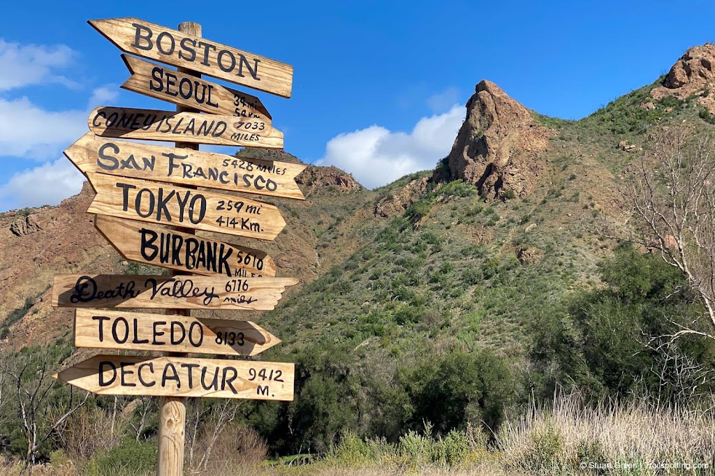
Home is a lot closer than this replica sign makes it look.
The 20th Century Fox Ranch, now known as Malibu Creek State Park, is a wonder of dramatic vistas that are different in every direction in which you might look. Which explains why it continues to be so popular as a movie filming location. Cary Grant, Marilyn Monroe, Marlon Brando, Humphrey Bogart, Bette Davis, Elvis Presley and Paul Newman have worked on set here.
⬤ Crags Road Trail
The Malibu Creek park is possibly best known however for the M*A*S*H movie and television show where many of the exterior shots were filmed for over a decade. Follow the Crags Road trail for 2.4 miles and you'll be on the set yourself, complete with a restored ambulance, a replica signpost and two burned out vehicles that were used in the last season of the show. Be sure to look for the helipad area, just South of the former camp site.
On the way you'll also pass by the site of the village from the Planet Of The Apes (1968) movie. The park has some great interpretive signs reminding you of this and other park facts.
| ⬤ 5★ Crags Road Trail
GPX File · AllTrails · Directions GPX? |
| ⬤ 4★ Crags Road to Rock Pools
GPX File · AllTrails · Directions |
| ⬤ 4★ Side Trip: Lookout Trail |
| ⬤ 4★ Side Trip: Chaparral Trail |
The walk down the wide Crags Road is undemanding and flat, but with the dramatic landscapes to keep you entertained you'll hardly notice. At around the 1.6 mile mark things get a little harder where the creek has found its own path around what looks like something that was intended to be a bridge. To pass the creek you'll want to look around for the best way across - I saw people navigate a makeshift crossing of logs, but I chose to head to my left where I found a place that I could just stride across. From here the road narrows into a trail, snaking through the canyon to the M*A*S*H location.
Some like to end their hike with the M*A*S*H filming location at the 2.4 mile mark, but if you have the energy we'd recommend continuing to the trail's end at the base of the Malibou (sic) Lake dam. Although there's no way to see or access the lake itself, you do pass close by more of the local rocky terrain.

A restored M*A*S*H 4077 ambulance.
The gorges in Malibu Creek park were formed from layers of sea-floor lava which became tilted and exposed to the air by compression between the North American and Pacific tectonic plates. Air bubbles were originally trapped in the seafloor lava as it rapidly cooled, and now exposed to the elements those odd holes in the rock now make great nesting places for the hundreds of white-throated swifts that flit around the canyon.
⬤ Crags Road to Rock Pools
Not everyone comes here to hike the movie locations. Malibu Canyon is a great setting for a picnic, and others like to hike as far as the rock pools or climb the walls and boulders nearby. We've plotted out a shorter hike that will lead you to the rock pools which is usually busy with waders and sightseers.
⬤ Side Trip: Lookout Trail
Extend your journey by 1.0 miles and 300 feet by heading up the Cage Creek trail (keep right) and looping around on the Lookout Trail for some excellent Malibu Creek Canyon views.
⬤ Side Trip: Chaparral Trail
This route behind the visitor center winds around the hillside and back to Crags Road. Total journey length is increased by only 0.3 miles and 170 feet if you use this as your return route rather than Crags Road.

One of many dramatic viewpoints along the Crags Road trail.

Plenty of places for a picnic, close to the parking lot.

Filming location for the Planet Of The Apes village..
Tangents:
• Official: Malibu Creek SP
• AllTrails Public: Malibu Lake Tr
• More Links: Movie Location
• Facebook Group: Comment, Follow Us

LA's Best Trails
Explore the natural side of Los Angeles with Trailspotting's Best Trails feature.
Explore the natural side of Los Angeles with Trailspotting's Best Trails feature.

Best Trails of California
See our favorite hiking trails for each region of California.
See our favorite hiking trails for each region of California.

Trailspotting the Southwest
See our growing collection of hikes from the Southwestern US states.
See our growing collection of hikes from the Southwestern US states.


