Best of Monadnock Region, NH
 Home to the famed mountain of the same name, the region of Monadnock encompasess the banks of the Connecticut River to the west, and towns including Keene, Peterborough, Jaffrey and Hillsborough. The area features several other notable peaks offering great hikes, and is criss-crossed with a number of former railroad routes that can now be explored at will as rail trails.
We list here our favourite trails of the region, summarized below with links to our trail rreviews that feature photography and route maps that you can use on your phone for easy navigation. Did we miss your favorite trail? Let us know and we'll make sure to check it out.
Hiking Trails
Rail Trails
.
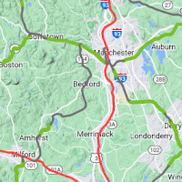
Regional Map
Regional Map
Regional Categories
| • Rating | |
| • Type | |
| • Difficulty | |
| • Mileage | |
| • 4+ Star Hikes |
Tangents:
• Facebook Group: Comment, Follow Us

Best Trails of New Hampshire
See our favorite hiking trails and rail trails for each region of New Hampshire.
See our favorite hiking trails and rail trails for each region of New Hampshire.

Rail Trail Map of New Hampshire
The first and only complete state rail trail map. With links to our reviews, photos & detailed route maps.
The first and only complete state rail trail map. With links to our reviews, photos & detailed route maps.

Fire Towers of New Hampshire
Discover our map of NH fire towers and the trails on which to find them.
Discover our map of NH fire towers and the trails on which to find them.


