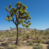
Paradise Canyon, St George UT
• 4-star hikes
• 3 mile loops
• Easy | Gain 310 to 380 feet
• St George, UT | Southwest US Region
.

This popular hiking trail is also an easy mountain biking route.
Located two hours east of Las Vegas, St George is a booming city surrounded by dramatic deserts and fiery red sandstone mountains. A great place for hiking in its own right, it's also a gateway to Zion National Park and many other of the US Southwest's celebrated natural wonders.
The access to Paradise Canyon begins at an unassuming trailhead among the sprawling suburbia of northwest St George, but almost immediately transports you away from any sign of civilization and into the Red Cliffs National Conservation Area. This large protected natural reserve is comprised of deep red sandstone outcroppings, contrasting against the green of hardy desert vegetation and long scenic landscape views.
| ⬤ 4★ Paradise Rim & Turtle Wall
GPX File · AllTrails · Directions GPX? |
| ⬤ 4★ Paradise Rim & Beck Hill
GPX File · AllTrails · Directions |
| P Free parking |
Both routes offer mostly firm trails underfoot with occasional shallow sand. The loop including Beck Hill Trail promises more distant views but Turtle Wall provides for a fun ramble along a ragged wall-hugging route. Both trails head to a dramatic westerly overlook before looping back to the start. You can't miss the junction between the fork in the trails, which is well marked by signage but also by a tall small sandstone keyhole arch.
Note that these trails are popular with mountain bikers and equestrians as well as hikers, so be sure to give other trail users the wide berth they need to enjoy Paradise Canyon.

Wide vistas and wall-hugging trails on the Turtle Wall Trail.

Rock outcropping with keyhole arch marks the Turtle Wall Trail junction.

More views on the slightly longer Beck Hill Trail.
Tangents:
• AllTrails Public: Paradise Canyon Trail
• Facebook Group: Leave a comment

Trailspotting the Southwest
See our growing collection of hikes from the Southwestern US states.
See our growing collection of hikes from the Southwestern US states.

Joshua Tree's Best Trails
The hikes around Joshua Tree National Park reviewed and categorized.
The hikes around Joshua Tree National Park reviewed and categorized.

LA's Best Trails
Explore the natural side of LA with Trailspotting's Best Trails feature.
Explore the natural side of LA with Trailspotting's Best Trails feature.


