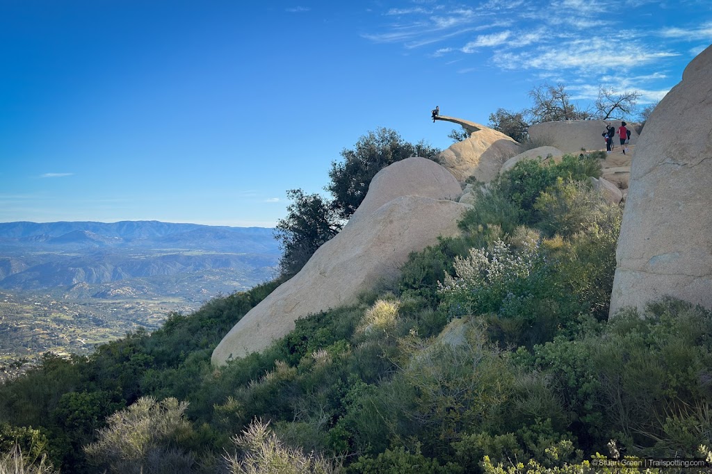
Potato Chip Rock & Mt Woodson, CA
• 5-star hikes
• 4 to 8 mile options
• Moderate | Gain 1,220 to 2,170 feet
• Poway, CA | San Diego Region
.

Hanging out on Potato Chip Rock near Mt Woodson's summit.
Hiking from Lake Poway up the western flanks of Mount Woodson is a must-do for locals and visitors alike, showcasing the San Diego region's natural beauty, offering breathtaking views and the chance for a popular photo opportunity.
Capable hikers will find the steady 2,170 foot climb to be only a moderate challenge without any difficult terrain, but sun and heat exposure is a real issue on this mountain, especially since Potato Chip rock attracts many unfamiliar with the risks hikers often face. Rangers recommend bringing 2 liters (68oz) of water per person in addition to sunscreen and snacks.
| ⬤ 5★ Mt Woodson Trail
GPX File · AllTrails · Directions GPX? |
| ⬤ Fry-Koegel Loop
AllTrails Public · Directions |
| ⬤ Mt Woodson Road
AllTrails Public · Directions |
| P Free parking |
Early on a sunny morning, Mount Woodson casts a large shadow over Lake Poway Park and this makes for a perfect opportunity for a comfortable hike on a quiet route. The trail traces a route above the southern banks of Lake Poway before heading upward through sandstone boulder-strewn terrain along the mountain's long sloping ridgeline.
You'll spot Potato Chip Rock before you reach the summit – a thin, impossible-looking stone sliver that still manages to bear the weight of the hundreds of people that scale it, in pursuit of a photograph. This site is extremely busy at weekends, so either expect to wait in line for a photo or visit at a quiet time.

Early morning Lake Poway still within the shadow of Mt Woodson.
Mount Woodson's summit is spoiled by a large collection of radio antennas and noisy support buildings, but it's still worth checking out to marvel at some enormous sandstone boulders that appear to sit precipitously atop the mountain.
Lake Poway Recreation Area has plenty of parking and amenities including large lush grassy expanses with plenty of shade for a post-hike picnic. There are easier and shorter routes up the mountain if you don't mind roadside parking along the busy Route 67 on the eastern side of the mountain. Mount Woodson Road provides a paved 2-mile route to the summit that requires only 1,220 feet of elevation gain. From the summit you can return the way you came, or continue on a looping route that returns via the Fry Koegel Trail for a total distance of 5.4 miles. We’ve included AllTrails links to these routes below.
⚠ Heat Safety Tips: Shade is extremely limited on this trail. Please stay safe in hot weather by knowing the forecast and planning to avoid the hottest parts of the day. Recognize danger signs and turn back when necessary. Wear lightweight non-cotton clothing and head coverings. Use sunblock and UV chapstick. Bring more water than you think you need, coupled with salt & electrolite tablets.

Boulder-strewn Mount Woodson with dazzling morning sun.

Another view of Potato Chip Rock.
Tangents:
• Official Link: Lake Poway
• Facebook Group: Comment, Follow Us

Trailspotting Nearby
5★ Annie's Canyon (2 mi) ·
4★ Iron Mountain (6-9 mi) ·
3★ Cowles Mountain (3 mi) ·
Show Map

California Summits
Explore mountain-top hikes around California with Trailspotting.
Explore mountain-top hikes around California with Trailspotting.

Best Trails of San Diego
From coast to mountains to desert plains in San Diego County.
From coast to mountains to desert plains in San Diego County.


