Annie's Canyon, Encinitas CA
• 5-star hike
• 2 mile part-loop
• Moderate | Gain 190 feet
• Encinitas, CA | San Diego Region
.

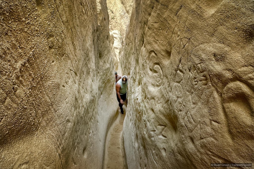
A tight squeeze in Annie's Canyon.
Combining the expansive views over the San Elijo Lagoon Ecological Preserve with a tour through the tight spaces of Annie's Canyon provides a fun and dramatic coastal hike near Encinitas, CA. This route is great for families and hikers of all levels of ability, plus those hesitant about squeezing through the narrow canyon walls have an alternative option of appreciating it from above.
Begin at the end of North Rios Avenue at Solana Beach and follow the trail along the wetlands inland towards the canyon. Expect to find binocular wielding birders here spotting osprey, egrets and other wildfowl along the main trail and a couple of short loops that offer a little more seclusion.
| ⬤ 5★ Rios Ave to Annie's Canyon
GPX File · AllTrails · Directions GPX? |
| P Free parking |
The entrance to Annie's Canyon Trail is marked with a sign that prompts you to make a decision. Turn right to hike through the slot canyon or take a left up a series of switchbacks that lead to the canyon viewpoint. We'd recommend a right turn to everybody, since you can explore the canyon as far as you feel comfortable and then turn back if you prefer. Expect to find the canyon initially easy going, becoming tighter and requiring climbs up several large steps.
The last part of the canyon climb is accomplished with help from a set of some steel steps that should be easy for most. The uphill switchbacks lead to a partial viewpoint of the canyon, but the views here are nowhere near as dramatic as exploring the canyon for yourself. The switchback trail is also used as the return route back to the start of the canyon loop, where like us you may choose to go through the canyon again!

Hiking the Rios Avenue Trail by San Elijo Lagoon.
Annie's Canyon is periodically closed after wet weather makes the route difficult and prone to trail damage. Check the official Nature Collective link at the bottom of this article to confirm that the trail is open. The public map at AllTrails is also linked below and recent comments can also provide enlightenment on the status of the canyon trail, though AllTrails often describes the route closed when it is actually open.
Roadside parking is available close to trailhead and the end of North Rios Avenue which is a residential neighborhood. As this is a popular trail, parking spots can fill up a long way down the street. We've also linked an alternative Solana Hills Drive trailhead and trail route in an AllTrails link below, but following close to Interstate 5 this trail is less desirable than the route along Rios Avenue Trail.

Entering the canyon.

Narrow gully walls. | Etchings in a small cavern.
Tangents:
• Official Site: Nature Collective
• AllTrails Public: Rios Ave, Solana Hills
• Facebook Group: Comment, Follow Us

Trailspotting Nearby
5★ Potato Chip (4-8 mi) ·
4★ Los Peñasquitos Canyon (6 mi) ·
4★ Iron Mountain (6-9 mi) ·
Show Map

California Coastlines
California coastal hikes and beaches to check out.
California coastal hikes and beaches to check out.

Best Trails of San Diego
From coast to mountains to desert plains in San Diego County.
From coast to mountains to desert plains in San Diego County.


