Posts
Showing posts with the label california+hike+4star
Fall Creek, Henry Cowell State Park, CA
• 4-star hike
• 4 mile part-loop
• Moderate | Gain 520 feet
• Felton, CA | Santa Cruz Region
…
• 4 mile part-loop
• Moderate | Gain 520 feet
• Felton, CA | Santa Cruz Region
…
Crystal Cove, Newport Beach CA
• 4-star hikes
• 3 to 5 mile options
• Moderate | Gain 480 to 1,060 feet
• Newport Beach, CA | Los Angeles Region
…
• 3 to 5 mile options
• Moderate | Gain 480 to 1,060 feet
• Newport Beach, CA | Los Angeles Region
…
South Lykken Trail, Palm Springs CA
• 3 & 4-star hikes
• 2 to 5 mile options
• Moderate | Gain 580 to 1,090 feet
• Palm Springs, CA | Southwest US Region
…
• 2 to 5 mile options
• Moderate | Gain 580 to 1,090 feet
• Palm Springs, CA | Southwest US Region
…
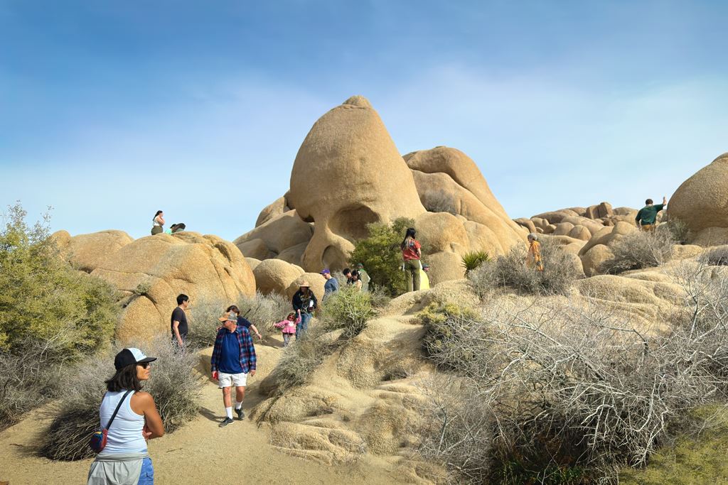
Skull Rock Nature Trail, Joshua Tree CA
• 4-star hike
• 2 mile loop
• Easy | Gain 140 feet
• Twentynine Palms, CA | Joshua Tree National Park
…
• 2 mile loop
• Easy | Gain 140 feet
• Twentynine Palms, CA | Joshua Tree National Park
…
The Nipple, Blue Lakes CA
• 4-star hikes
• 6 mile out-and-back
• Moderate | Gain 1,230 feet (Peak 9,342 ft)
• Markleeville, CA | Lake Tahoe
…
• 6 mile out-and-back
• Moderate | Gain 1,230 feet (Peak 9,342 ft)
• Markleeville, CA | Lake Tahoe
…
Slot Canyon, Anza-Borrego Desert, CA
• 4-star hike
• 2.2 mile loop
• Medium difficulty | Gain 300 feet
• Ocotillo Wells, CA | Southwest US
…
• 2.2 mile loop
• Medium difficulty | Gain 300 feet
• Ocotillo Wells, CA | Southwest US
…
Ryan Mountain, Joshua Tree CA
• 4-star hike
• 3.0 mile out-and-back
• Medium difficulty | Gain 1,070ft (Peak 5,456ft)
• Twentynine Palms, CA | Joshua Tree National Park
…
• 3.0 mile out-and-back
• Medium difficulty | Gain 1,070ft (Peak 5,456ft)
• Twentynine Palms, CA | Joshua Tree National Park
…
Barker Dam Nature Trail, Joshua Tree CA
• 4-star hike
• 1.3 mile loop
• Easy difficulty | Gain 66 feet
• Twentynine Palms, CA | Joshua Tree National Park
…
• 1.3 mile loop
• Easy difficulty | Gain 66 feet
• Twentynine Palms, CA | Joshua Tree National Park
…
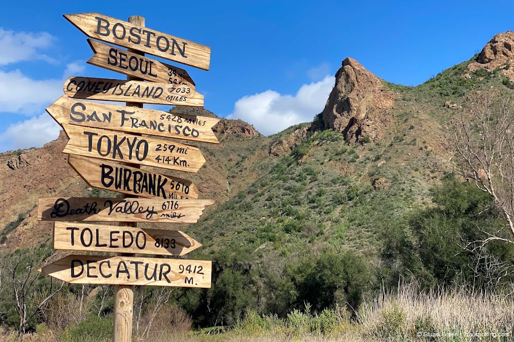
Malibu Creek State Park, CA
• 5-star hike
• 2.2 to 6.3 mile options
• Easy difficulty | Gain 80 to 370 feet
• Calabasas, CA | Los Angeles Region
…
• 2.2 to 6.3 mile options
• Easy difficulty | Gain 80 to 370 feet
• Calabasas, CA | Los Angeles Region
…
Hollywood Sign & Hollywood Hills, CA
• 5-star hikes
• 2.5 to 5.5 mi options
• Easy &Medium difficulty | Gain 510 to 1,290 feet
• Hollywood, CA | Los Angeles Region
…
• 2.5 to 5.5 mi options
• Easy &Medium difficulty | Gain 510 to 1,290 feet
• Hollywood, CA | Los Angeles Region
…
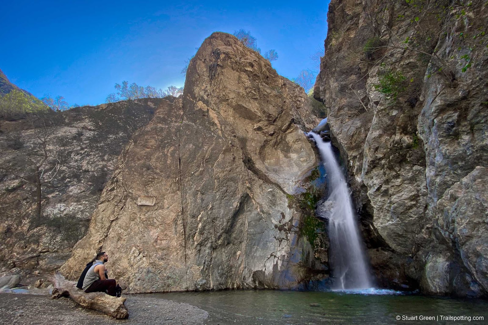
Eaton Canyon Falls, Pasadena CA
• 4-star hike
• 3.4 to 4.2 mile options
• Easy/Medium difficulty | Gain 420 to 790 feet
• Pasadena, CA | Los Angeles Region
…
• 3.4 to 4.2 mile options
• Easy/Medium difficulty | Gain 420 to 790 feet
• Pasadena, CA | Los Angeles Region
…
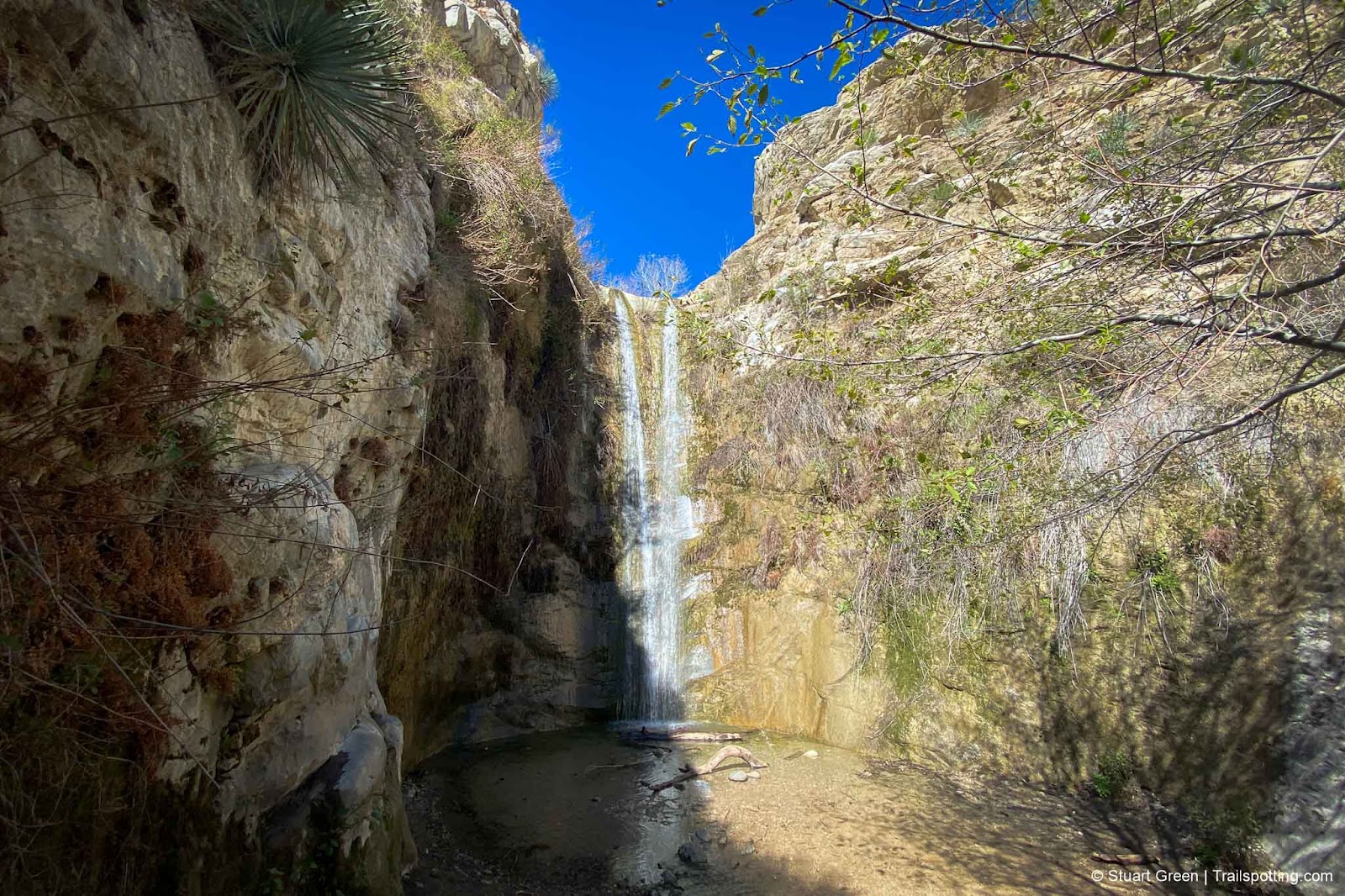
Trail Canyon Falls, Los Angeles CA
• 4-star hike
• 4.2 mile out-and-back
• Medium difficulty | Gain 990 feet
• Sunland, CA | Los Angeles Region
…
• 4.2 mile out-and-back
• Medium difficulty | Gain 990 feet
• Sunland, CA | Los Angeles Region
…
Solstice Canyon, Malibu CA
• 5-star hike
• 2.5 to 6.1 mile options
• Easy/medium difficulty | Gain 310 to 1,800 feet
• Malibu CA | Los Angeles Region
…
• 2.5 to 6.1 mile options
• Easy/medium difficulty | Gain 310 to 1,800 feet
• Malibu CA | Los Angeles Region
…
Edgewood County Park, Redwood City CA
• 4-star hike
• 1.8 mile loop
• Medium difficulty | Gain 400 feet
• Redwood City, CA | San Francisco Bay Area
…
• 1.8 mile loop
• Medium difficulty | Gain 400 feet
• Redwood City, CA | San Francisco Bay Area
…
Presidio Ecology Trail and Lovers Lane CA
• 4-star hike
• 2.0 mile loop
• Easy difficulty | Gain 200 feet
• San Francisco, CA | San Francisco Bay Area
…
• 2.0 mile loop
• Easy difficulty | Gain 200 feet
• San Francisco, CA | San Francisco Bay Area
…
Pinecrest Lake Loop, Strawberry CA
• 4-star hike
• 3.8 mile loop
• Medium difficulty | Gain 360 feet (Peak 5,725 feet)
• Strawberry, CA
…
• 3.8 mile loop
• Medium difficulty | Gain 360 feet (Peak 5,725 feet)
• Strawberry, CA
…
Coast View Loop, Mt Tamalpais CA
• 4-star hike
• 8.3 mile loop
• Medium difficulty | Gain 1,500 feet
• Mill Valley, CA | San Francisco Bay Area
…
• 8.3 mile loop
• Medium difficulty | Gain 1,500 feet
• Mill Valley, CA | San Francisco Bay Area
…
Mount Diablo to Eagle Peak CA
• 4-star hike
• 6.8 mile out & back
• Medium difficulty | Gain 1,923 feet
• Contra Costa, CA | San Francisco Bay Area
…
• 6.8 mile out & back
• Medium difficulty | Gain 1,923 feet
• Contra Costa, CA | San Francisco Bay Area
…
Mission Peak Regional Preserve CA
• 4-star hike
• 6.0 mile loop
• Medium difficulty | Gain 1,920 to 2,150 feet
• Fremont, CA | San Francisco Bay Area
…
• 6.0 mile loop
• Medium difficulty | Gain 1,920 to 2,150 feet
• Fremont, CA | San Francisco Bay Area
…
Built for fun by humans | Trailspotting is non-commercial, ad-free | Copyright © 2024 Stuart Green all rights reserved | Content provided without warranty of accuracy | About